


The Atlantic’s first hurricane of 2025 just made its grand entrance — and it’s not pulling any punches.
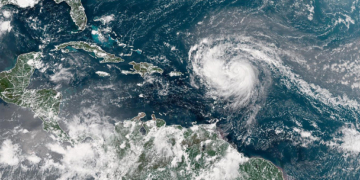
Erin officially strengthened into a hurricane Friday as it pushed toward the northeast Caribbean, triggering urgent warnings of flooding and landslides, according to the Associated Press.
While the storm is forecast to stay offshore for now, it’s already setting off alarms across the region. Tropical storm watches have been issued for several islands, including Anguilla, Barbuda, St. Martin, St. Barts, Saba, St. Eustatius, and St. Maarten.
Heavy rain is expected to slam Antigua and Barbuda, the U.S. and British Virgin Islands, and southern and eastern Puerto Rico. Forecasters warn of “up to 4 inches (10 centimeters)” of rainfall, with “isolated totals of up to 6 inches (15 centimeters),” according to the National Hurricane Center in Miami. On top of that, dangerous swells could add to the already volatile conditions.
As of Friday, the storm’s center was located about 415 miles (665 kilometers) east of the Northern Leeward Islands, packing maximum sustained winds of 75 mph (120 kph), while moving west-northwest at 17 mph (28 kph). Erin may be far from U.S. shores, but it’s drawing eyes — and concern — from meteorologists nationwide.
Hurricane specialist and storm surge expert Michael Lowry offered a glimmer of relief — for now: “The forecasts for next week still keep the future hurricane safely east of the mainland U.S.” But the path could shift.
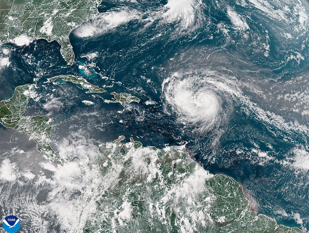
According to the National Hurricane Center, Erin is “forecast to become a major Category 3 storm late this weekend and pass some 200 miles (320 kilometers) north of Puerto Rico.”
And there’s more potential power behind this system. Accuweather’s lead hurricane expert Alex DaSilva didn’t mince words: “Erin is forecast to explode into a powerful Category 4 hurricane as it moves across very warm waters in the open Atlantic. Water temperatures at the surface and hundreds of feet deep are several degrees higher than the historical average.”
With those conditions in play, the potential for major damage looms even if the storm doesn’t make direct landfall.
The National Hurricane Center also issued a cautionary note: “There is still uncertainty about what impacts Erin may bring to portions of the Bahamas, the east coast of the United States, and Bermuda in the long range.”
One thing is certain — Erin is already flexing. Dangerous surf and rip currents are expected to pound the U.S. East Coast next week, with Accuweather warning of waves up to 15 feet (5 meters) along parts of the North Carolina coast, threatening beach erosion and possible structural damage.
Erin is the fifth named storm of this year’s Atlantic hurricane season, which officially runs from June 1 to November 30. And this season? It’s just getting started.
Forecasters predict an unusually active year, with six to 10 hurricanes expected — and three to five potentially reaching major hurricane status, packing winds over 110 mph (177 kph).
Buckle up. Erin might be the first, but she won’t be the last.


