


Hurricane Erin is back on the rise — and forecasters say the worst could be yet to come.
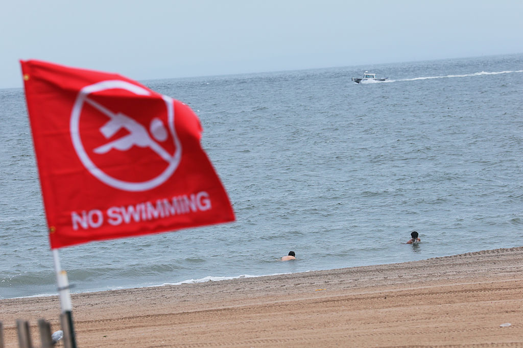
The massive Atlantic storm began strengthening again on Wednesday, stirring up dangerous waves and rip currents that have already closed beaches from the Carolinas to New York City and forced emergency crews into action, according to the Associated Press.
Forecasters expect Erin to peak over the next 48 hours, and say the storm could re-intensify into a major hurricane by Wednesday night — potentially pushing sustained winds beyond Category 3 strength.
While Erin is still unlikely to make landfall, the storm’s vast reach is threatening communities far beyond its center. Officials warn that large swells will cut off roads to villages and vacation homes on North Carolina’s Outer Banks, and life-threatening rip currents are expected from Florida to New England.
New York City has closed its beaches to swimming for both Wednesday and Thursday, with similar closures reported in New Jersey, Maryland, and Delaware. Nantucket Island, off the coast of Massachusetts, could see waves over 10 feet (3 meters) later this week.
The Outer Banks, however, remain the epicenter of concern.
Despite repeated warnings, some swimmers continue to defy beach closures. At Wrightsville Beach, North Carolina, rescuers pulled more than a dozen people from rip currents on Tuesday, following over 80 rescues the day before.
“You can be aware all you want,” said Bob Oravec, lead forecaster at the National Weather Service in Maryland. “It can still be dangerous.”
North Carolina officials are bracing for the worst, warning of flooding, beach erosion, and 20-foot waves battering coastal communities.
“Regardless of the track of the center of the storm, dangerous conditions can be felt far from the eye, especially with a system as large as Erin,” said Will Ray, the state’s emergency management director.
The sheer size of Erin is staggering. With tropical-storm-force winds stretching 500 miles (800 kilometers) from edge to edge — roughly the distance from New York City to Pittsburgh — the storm is already being felt across vast portions of the East Coast.
David Hallac, superintendent of Cape Hatteras National Seashore, warned that dozens of beachfront homes already weakened by erosion and dune loss are now at risk.
The National Hurricane Center also confirmed it’s monitoring two additional tropical disturbances east of Erin, both potential threats brewing over thousands of miles of warm ocean water — the perfect conditions for Cape Verde storms, known to be among the most dangerous hurricanes to threaten North America.
As of Wednesday, Atlantic water had already begun washing onto the main route through the Outer Banks, and officials warned it could become impassable during high tide.
Mandatory evacuations remain in effect on Hatteras and Ocracoke Islands, but many residents are staying put.
“We probably wouldn’t stay if it was coming directly at us,” said Rob Temple, who operates sailboat cruises on Ocracoke. His biggest concern now: whether the main road will be washed out, cutting the islands off from tourists, supplies, and emergency services.
As of Wednesday afternoon, Erin held strong as a Category 2 hurricane, packing maximum sustained winds of 110 mph (180 kph). It was located about 365 miles (590 kilometers) south-southeast of Cape Hatteras, and its enormous wind field continues to grow.
Tropical storm warnings are now in effect for parts of North Carolina and Virginia, and in Bermuda, officials are urging people to stay out of the water through Friday.
Meanwhile, climate scientists warn that hurricanes like Erin are becoming more powerful and dangerous than ever before, fueled by increasingly warm ocean waters — a trend that’s turning ordinary storms into rapidly intensifying, catastrophic events.
For now, all eyes remain on the coast as Erin builds again. The clock is ticking.


