
The National Mall is a landscaped park near the downtown area of Washington, D.C., the capital city of the United States. It contains and borders a number of museums of the Smithsonian Institution, art galleries, cultural institutions, and memorials, sculptures, and statues. It is administered by the National Park Service (NPS) of the United States Department of the Interior as part of the National Mall and Memorial Parks unit of the National Park System. The park receives approximately 24 million visitors each year. Designed by Pierre L'Enfant, the "Grand Avenue" or Mall was to be a democratic and egalitarian space—unlike palace gardens, such as those at Versailles in France, that were paid for by the people but reserved for the use of a privileged few.
The core area of the National Mall extends between the United States Capitol grounds to the east and the Washington Monument to the west and is lined to the north and south by several museums and federal office buildings. The term National Mall may also include areas that are officially part of neighboring West Potomac Park to the south and west and Constitution Gardens to the north, extending to the Lincoln Memorial on the west and Jefferson Memorial to the south.
Contents
Landmarks, museums, and other features
Within the National Mall proper
The National Mall proper contains the following landmarks, museums and other features (including opening year):
Not marked on the above image:
Above the Smithsonian Institution Building
Joseph Henry statue (1883)
Below the Smithsonian Institution Building
Andrew Jackson Downing Urn (1856)
Above the Arts and Industries Building
Smithsonian Carousel (1967) which was removed for renovations in November 2023, and returned to the same spot in April 2026, in time to celebrate the United States' 250th anniversary
To the left of the National Museum of American History
Site of the present National Museum of African American History and Culture (2016)
To the left of the Freer Gallery of Art
Jamie L. Whitten Building: U.S. Department of Agriculture Administration Building (1930)
With the exception of the National Gallery of Art, all of the museums on the National Mall proper are part of the Smithsonian Institution. The Smithsonian Gardens maintains a number of gardens and landscapes near its museums. These include:
East of the National Mall proper
Features east of the National Mall proper include:
West of the National Mall proper and in West Potomac Park
Not included in the above map:
Lockkeeper's House, C & O Canal Extension (1837)
Constitution Gardens (1976)
Memorial to the 56 Signers of the Declaration of Independence (1984)
District of Columbia War Memorial
Sylvan Theater
George Mason Memorial
John Paul Jones Memorial
John Ericsson Memorial
The Arts of War and The Arts of Peace sculptures
Jefferson Pier
Tidal Basin paddle-boat dock.
Boundaries and dimensions
Dimensions
Between the Capitol steps and the Lincoln Memorial, the Mall spans 1.9 miles (3.0 km).
Between the Capitol steps and the Washington Monument, the Mall spans 1.2 miles (1.8 km).
Between the Ulysses S. Grant Memorial and the Lincoln Memorial, the Mall covers 309.2 acres (125.13 ha).
Between Constitution Avenue NW and Independence Avenue SW at 7th Street, the width of the Mall is 1,586 feet (483 m).
Between Madison Drive NW and Jefferson Drive SW at 7th Street, the width of the Mall's open space is 656 feet (200 m).
Between the innermost rows of trees near 7th Street, the width of the Mall's vista is 300 feet (91 m).
Boundaries
In its 1981 National Register of Historic Places nomination form, the NPS defined the boundaries of the National Mall (proper) as Constitution and Pennsylvania Avenues on the north, 1st Street NW on the east, Independence and Maryland Avenues on the south, and 14th Street NW on the west, with the exception of the section of land bordered by Jefferson Drive on the north, Independence Avenue on the south, and by 12th and 14th Streets respectively on the east and west, which the U.S. Department of Agriculture administers and which contains the Jamie L. Whitten Building (U.S. Department of Agriculture Administration Building). The 2012–2016 National Park Service index describes the National Mall as being a landscaped park that extends from the Capitol to the Washington Monument, defined as a principal axis in the L'Enfant Plan for the city of Washington.
A 2010 NPS plan for the Mall contains maps that show the Mall's general area to be larger. A document within the plan describes this area as "the grounds of the U.S. Capitol west to the Potomac River, and from the Thomas Jefferson Memorial north to Constitution Avenue". A map within the plan entitled "National Mall Areas" illustrates "The Mall" as being the green space bounded on the east by 3rd Street, on the west by 14th Street, on the north by Jefferson Drive, NW, and on the south by Madison Drive, SW. A Central Intelligence Agency map shows the Mall as occupying the space between the Lincoln Memorial and the United States Capitol.
In 2011, the 112th United States Congress enacted the Legislative Branch Appropriations Act, 2012, which transferred to the Architect of the Capitol the NPS "property which is bounded on the north by Pennsylvania Avenue Northwest, on the east by First Street Northwest and First Street Southwest, on the south by Maryland Avenue Southwest, and on the west by Third Street Southwest and Third Street Northwest". This act removed Union Square, the area containing the Ulysses S. Grant Memorial and the Capitol Reflecting Pool, from NPS jurisdiction.
Purposes
The National Park Service states that the purposes of the National Mall are to:
Provide a monumental, dignified, and symbolic setting for the governmental structures, museums, and national memorials as first delineated by the L'Enfant plan and further outlined in the McMillan plan.
Maintain and provide for the use of the National Mall with its public promenades as a completed work of civic art, a designed historic landscape providing extraordinary vistas to symbols of the nation.
Maintain National Mall commemorative works (memorials, monuments, statues, sites, gardens) that honor presidential legacies, distinguished public figures, ideas, events, and military and civilian sacrifices and contributions.
Forever retain the West Potomac Park section of the National Mall as a public park for the recreation and enjoyment of the people.
Maintain the National Mall in the heart of the nation's capital as a stage for national events and a preeminent national civic space for public gatherings because it is here that the constitutional rights of speech and peaceful assembly find their fullest expression.
Maintain the National Mall as an area free of commercial advertising while retaining the ability to recognize sponsors."
History
L'Enfant City Plan
In his 1791 plan for the future city of Washington, D.C., Pierre (Peter) Charles L'Enfant envisioned a garden-lined "grand avenue" approximately 1 mile (1.6 km) in length
and 400 feet (120 m) wide, in an area that would lie between the Congress House (now the United States Capitol) and an equestrian statue of George Washington. The statue would be placed directly south of the President's House (now the White House) and directly west of the Congress House (see L'Enfant Plan) on the site of the Washington Monument. The grand avenue was to be flanked by gardens and spacious accommodations for foreign ministers.
Mathew Carey's 1802 map is reported to be the first to name the area west of the United States Capitol as the "Mall". The name is derived from that of The Mall in London, which during the 1700s was a fashionable promenade near Buckingham Palace upon which the city's elite strolled.
The Washington City Canal, completed in 1815 in accordance with the L'Enfant Plan, travelled along the former course of Tiber Creek to the Potomac River along B Street Northwest (NW) (now Constitution Avenue NW) and south along the base of a hill containing the Congress House, thus defining the northern and eastern boundaries of the Mall. Being shallow and often obstructed by silt, the canal served only a limited role and became an open sewer that poured sediment and waste into the Potomac River's flats and shipping channel. The portion of the canal that traveled near the Mall was covered over in 1871 for sanitary reasons.
Some consider a lockkeeper's house constructed in 1837 near the western end of the Washington City Canal for an eastward extension of the Chesapeake & Ohio Canal to be the oldest building still standing on the National Mall. The structure, which is located near the southwestern corner of 17th Street NW and Constitution Avenue NW, is west of the National Mall (proper).
The Smithsonian Institution Building ("The Castle"), constructed from 1847 to 1855, is the oldest building now present on the National Mall (proper). The Washington Monument, whose construction began in 1848 and reached completion in 1888, stands near the planned site of its namesake's equestrian statue. The Jefferson Pier marks the planned site of the statue.
Downing Plan: Mid-19th century
During the early 1850s, architect and horticulturist Andrew Jackson Downing designed a landscape plan for the Mall. Over the next half century, federal agencies developed several naturalistic parks within the Mall in accordance with Downing's plan. Two such areas were Henry Park and Seaton Park.
During that period, the Mall was subdivided into several areas between B Street Northwest (NW) (now Constitution Avenue NW) and B Street Southwest (SW) (now Independence Avenue SW):
The Public Grounds between 2nd and 6th Streets NW and SW
The Armory Grounds between 6th and 7th Streets NW and SW
The Smithsonian Grounds between 7th and 12th Streets NW and SW
The Agricultural Grounds between 12th and 14th Streets NW and SW
The Monument Grounds between 14th and 17th Streets NW and SW
In 1856, the Armory (No. 27 on the 1893 map of the Mall) was built at the intersection of B Street SW and 6th Street SW on the Armory Grounds. In 1862, during the American Civil War, the building was converted to a military hospital known as Armory Square Hospital to house Union Army casualties. After the war ended, the Armory building became the home of the United States Fish Commission.
The United States Congress established the United States Department of Agriculture in 1862 during the Civil War. Designed by Adolf Cluss and Joseph von Kammerhueber, the United States Department of Agriculture Building (No. 25 on the map), was constructed in 1867–1868 north of B Street SW within a 35-acre site on the Mall.
After the Civil War ended, the Department of Agriculture started growing experimental crops and demonstration gardens on the Mall. These gardens extended from the department's building near the south side of the Mall to B Street NW (the northern boundary of the Mall). The building was razed in 1930. In addition, greenhouses belonging to the U.S. Botanical Garden (No. 16 on the map) appeared near the east end of the Mall between the Washington City Canal and the Capitol (later between 1st and 3rd Streets NW and SW).
McMillan Plan: Early 20th century
In 1902, the McMillan Commission's plan, which was partially inspired by the City Beautiful Movement and which purportedly extended Pierre L'Enfant's plan, called for a radical redesign of the Mall that would replace its greenhouses, gardens, trees, and commercial/industrial facilities with an open space. The plan differed from L'Enfant's by replacing the 400 feet (120 m) wide "grand avenue" with a 300 feet (91 m) wide vista containing a long and broad expanse of grass.
Four rows of American elm trees (Ulmus americana) planted fifty feet apart between two paths or streets would line each side of the vista. Buildings housing cultural and educational institutions constructed in the Beaux-Arts style would line each outer path or street, on the opposite side of the path or street from the elms.
In subsequent years, the vision of the McMillan plan was generally followed with the planting of American elms and the layout of four boulevards down the Mall, two on either side of a wide lawn. In accordance with a plan that it completed in 1976, the NPS converted the two innermost boulevards (Washington Drive NW and Adams Drive SW) into gravel walking paths. The two outermost boulevards (Madison Drive NW and Jefferson Drive SW) remain paved and open to vehicular traffic.
Temporary war buildings
During World Wars I and II, the federal government constructed a number of temporary buildings (tempos) on the Mall, disrupting the area's planned layout. Most of these buildings were in two clusters: one near the Lincoln Memorial Reflecting Pool and the other on the National Mall (proper) in the vicinity of 4th through 7th Streets NW and SW.
The United States entered World War I in April 1917. By 1918, a row of tempos designated from north to south as Buildings A, B, and C had stretched across the Mall along the east side of the former railroad route on 6th Street. The smokestacks of the buildings' centrally located power plant were set apart to preserve the view of the Washington Monument from the Capitol building. Soon afterwards, the government constructed Buildings D, E and F to the east and west of the row.
Around 1921 (when the United States and Germany signed the U.S.–German Peace Treaty, thus formally ending the war between the two nations), the government demolished Buildings A and B. The remaining tempos held offices of several agencies belonging to the Agriculture, Commerce, Treasury and War Departments for a number of years after the war ended.
The government then slowly dismantled most of the tempos that had remained within the Mall (proper), removing the power plant and nearby buildings by 1936. Among those removed was Building C, which the government demolished between 1933 and 1936.
By 1937, the government had removed all of the World War I tempos that had been within the National Mall (proper) except for Building E, thus largely restoring the Mall's central vista. However, another World War I tempo, which the government constructed south of the Mall in 1919 between 14th Street SW and the Tidal Basin as the Liberty Loan Building, remained standing in 2019 while housing the Treasury Department's Bureau of the Fiscal Service.
In 1918, contractors for the United States Navy's Bureau of Yards and Docks constructed the Main Navy and Munitions Buildings along nearly a third of a mile of the south side of Constitution Avenue (then known as B Street), from 17th Street NW to 21st Street NW. Although the Navy intended the buildings to provide temporary quarters for the United States military during World War I, the reinforced concrete structures remained in place until 1970. After their demolition, much of their former sites became Constitution Gardens, which was dedicated in 1976.
Later history
The planting of American elm trees (Ulmus americana) on the National Mall following the McMillan Plan started in the 1930s between 3rd and 14th Streets at the same time that Dutch Elm Disease (DED) began to appear in the United States. Concern was expressed about the impact that DED could have on these trees.
DED first appeared on the Mall during the 1950s and reached a peak in the 1970s. The NPS has used a number of methods to control this fungal epidemic, including sanitation, pruning, injecting trees with fungicide and replanting with DED-resistant American elm cultivars (see Ulmus americana cultivars). The NPS cloned one such cultivar ('Jefferson') from a DED-resistant tree growing near a path on the Mall in front of the Freer Gallery of Art, near the Smithsonian Institution Building ("The Castle").
The NPS has combated the disease's local insect vector, the smaller European elm bark beetle (Scolytus multistriatus), by trapping and by spraying with insecticides. Soil compaction and root damage by crowds and construction projects also adversely affect the elms.
On October 15, 1966, the NPS listed the National Mall on the National Register of Historic Places. In 1981, the NPS prepared a National Register nomination form that documented the Mall's boundaries, features and historical significance.
From the 1970s to 1994, a fiberglass model of a triceratops named Uncle Beazley stood on the Mall in front of the National Museum of Natural History. The life-size statue, which is now located at the National Zoological Park (the National Zoo) in Northwest Washington, D.C., was donated to the Smithsonian Institution by the Sinclair Oil Corporation. The statue, which Louis Paul Jonas created for Sinclair's DinoLand pavilion at the 1964 New York World's Fair, was named after a dinosaur in Oliver Butterworth's 1956 children's book, The Enormous Egg, and the 1968 televised movie adaptation in which the statue appeared.
In 2003, the 108th United States Congress enacted the Commemorative Works Clarification and Revision Act. This Act prohibits the siting of new commemorative works and visitor centers in a designated reserve area within the cross-axis of the Mall.
Demolished or moved structures
Washington City Canal, covered over by Constitution Avenue NW, 3rd Street NW, and SW and Canal Street SW (now Washington Street SW)
Baltimore and Potomac Railroad Station, closed in 1907 when Washington Union Station opened
United States Department of Agriculture Building, demolished in 1930
Center Market, replaced in 1931 by the National Archives Building
Armory Square Hospital/Armory, replaced in 1976 by the National Air and Space Museum
Army Medical Museum and Library, demolished in 1968; replaced by the Hirshhorn Museum
Temporary Main Navy and Munitions Buildings, built in 1918, demolished in 1970; replaced by Constitution Gardens
Uncle Beazley, moved in 1994 to the National Zoo
Usage
In combination with the other attractions in the Washington Metropolitan Area, the National Mall makes the nation's capital city one of the most popular tourist destinations in the country. It has several other uses in addition to serving as a tourist focal point.
Protests and rallies
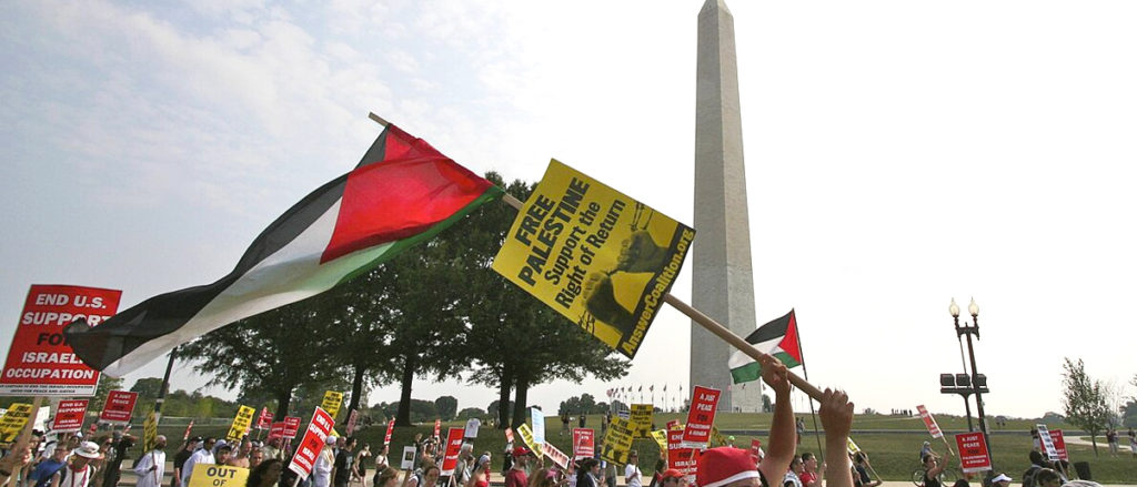
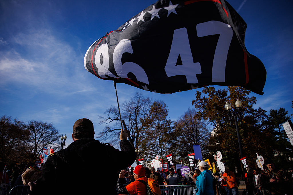
The National Mall's status as a vast, open expanse at the heart of the capital makes it an attractive site for protests and rallies of all types. One notable example was the 1963 March on Washington for Jobs and Freedom, a political rally during the Civil Rights Movement, at which Martin Luther King Jr. delivered his speech "I Have a Dream".
The largest officially recorded rally was the Vietnam War Moratorium Rally on October 15, 1969. However, in 1995, the NPS issued a crowd estimate for the Million Man March with which an organizer of the event, Nation of Islam leader Louis Farrakhan, disagreed. The next year, a committee of the 104th United States Congress provided no funds for NPS crowd-counting activities in Washington, D.C., when it prepared legislation making 1997 appropriations for the U.S. Department of the Interior.
As a result, the NPS has not provided any official crowd size estimates for Mall events since 1995. The absence of such an official estimate fueled a political controversy following the presidential inauguration of Donald Trump in 2017 (see: Inauguration of Donald Trump crowd size).
On April 25, 2004, the March for Women's Lives filled the Mall. On January 27, 2007, tens of thousands of protesters opposed to the Iraq War converged on the Mall (see: January 27, 2007 anti-war protest), drawing comparisons by participants to the Vietnam War protest.
On June 12, 2018, the National Hockey League's Washington Capitals staged a rally on the Mall after parading through the city to celebrate the franchise's first Stanley Cup championship. Tens of thousands of fans reportedly joined the beer-soaked event.
Presidential inaugurations
The American presidential inauguration is a momentous occasion that symbolizes the peaceful transfer of power and the beginning of a new chapter in the nation's leadership. Held at the United States Capitol in Washington, D.C., the inauguration draws people from across the country and the world to witness this historic event. The Capitol, with its majestic dome and iconic architecture, serves as the backdrop for the ceremony. The Mall, stretching from the Capitol to the Lincoln Memorial, becomes the gathering place for thousands of spectators who come to witness the swearing-in of the President and Vice President of the United States.
Days leading up to the inauguration are filled with anticipation and preparation. Security measures are heightened to ensure the safety of attendees and dignitaries. The National Mall, usually bustling with tourists and locals, transforms into a sea of spectators, eagerly awaiting the moment when the President-elect takes the oath of office. During presidential inaugurations, people without official tickets gather at the National Mall. Normally, the Mall between 7th and 14th Streets NW is used as a staging ground for the parade.
On December 4, 2008, the Presidential Inaugural Committee (see: United States presidential inauguration organizers) announced, "for the first time, the entire length of the National Mall will be opened to the public so that more people than ever before will be able to witness the swearing-in of the president from a vantage point in sight of the Capitol." The committee made this arrangement because of the massive attendance – projected to be as many as 2 million people – that it expected for the first inauguration of Barack Obama on January 20, 2009.
Despite the arrangement, a throng of people seeking access to the event climbed and then removed temporary protective fences around the Smithsonian's Mary Livingston Ripley Garden, six blocks from the site at which Obama took his inaugural oath. Hordes then trampled the garden's vegetation and elevated plant beds when entering and leaving the event. Others could not find a way to enter the Mall in time to view the ceremony. More than a thousand people with purple tickets missed the event while being stranded in the I-395 Third Street Tunnel beneath the Mall after police directed them there (see Purple Tunnel of Doom). Terrance Gainer, the Sergeant at Arms of the United States Senate, stated that it appeared that the stranding had occurred because there were more bulky people in coats than the event's purple section could accommodate. The Joint Congressional Committee on Inaugural Ceremonies subsequently announced that ticket holders that were not admitted would receive copies of the swearing-in invitation and program, photos of Obama and Vice President Joe Biden, and a color print of the ceremony.
Other events and recreational activities
The National Mall has long served as a spot for jogging, picnics, and light recreation for the Washington population. The Smithsonian Carousel, located on the Mall in front of the Arts and Industry Building, is a popular attraction. The Allan Herschell Company built the carousel, which arrived at Gwynn Oak Park near Baltimore, Maryland, in 1947. The carousel was moved to the Mall in 1981 and now operates seasonally. It was later removed for restoration in 2023, returning to the Mall in April 2026.
A number of large free events recur annually on the Mall. A kite festival, formerly named the "Smithsonian Kite Festival" and now named the "Blossom Kite Festival", usually takes place each year on the Washington Monument grounds during the last weekend of March as part of the National Cherry Blossom Festival. The event's organizers cancelled the 2020 kite festival, which they had earlier scheduled to take place on the Washington Monument grounds on Saturday, March 28, because of concerns related the ongoing coronavirus pandemic.
An Earth Day celebration often takes place on the Mall around April 22. A week-long series of rallies, exhibits, observances and performances occurred on the Mall from April 17 to April 25, 2010, to commemorate Earth Day's 40th anniversary. The final day's events featured performances by Sting, Mavis Staples, the Roots, John Legend and others.
The 2012 Earth Day rally, which featured music, entertainment, celebrity speakers and environmental activities, took place on the Mall during a rainy day on Sunday, April 22. Cheap Trick, Dave Mason, Kicking Daisies, Sting, John Legend, Joss Stone, the Roots, Mavis Staples, Jimmy Cliff, Bob Weir and the Explorers Club performed and Congressmen John Dingell and Edward Markey spoke.
In 2013, an "Earth Month" at Washington Union Station replaced the Mall's Earth Day event. On April 19, 2015, a "Global Citizen" Earth Day concert featured performances on the Washington Monument grounds by Usher, My Morning Jacket, Mary J. Blige, Train and No Doubt.
The National Symphony Orchestra presents each year its National Memorial Day Concert on the west lawn of the United States Capitol during the evening of the Sunday before Memorial Day (the last Monday of May). The National Gallery of Art hosts a Jazz in the Garden series each year in the museum's Sculpture Garden on Friday evenings from late May through August.
Improvements and refurbishment
National Mall Plan
From 2006 through 2010, the NPS conducted a public process that created a plan for the future of the National Mall. On July 13, 2010, the NPS issued in the Federal Register a notice of availability of a final environmental impact statement (EIS) for the National Mall Plan. The two-volume final EIS responded to comments and incorporated changes to a draft EIS for the Plan.
On November 9, 2010, the NPS and the Department of the Interior issued a Record of Decision (ROD) that completed the planning process. The ROD contains a summary of the selected alternative, which is the basis for the Plan, together with mitigation measures developed to minimize environmental harm; other alternatives considered; the basis for the decision in terms of planning objectives and the criteria used to develop the preferred alternative; a finding of no impairment of park resources and values; the environmentally preferable alternative; and the public and agency involvement.
The Plan proposed several changes to the Mall. The NPS would construct a vast expanse of paved surface in Union Square at the east end of the Mall to accommodate demonstrations and other events by reducing the size of the Capitol Reflecting Pool or by replacing the pool with a fountain or other minor water feature. Additional proposed changes included the replacement of the Sylvan Theater on the Washington Monument grounds with a facility containing offices, restaurants, and restrooms, as well as the replacement of an open space near the east end of Constitution Gardens with a multipurpose visitor facility containing food service, retail, and restrooms.
On December 2, 2010, the National Capital Planning Commission (NCPC) unanimously approved the final National Mall Plan at a public hearing. The NCPC's approval allowed the NPS to move forward with implementation of the Plan's recommendations.
On March 1, 2012, the NCPC discussed a proposal that, when implemented, reduced the Mall's green space by widening and paving most of the north–south walkways that cross the Mall between Seventh and Fourteenth Streets. The project also replaced with gravel large areas of grass that were located near the Smithsonian Metro Station and the National Gallery of Art's Sculpture Garden.
On September 8, 2011, the Trust for the National Mall and the NPS announced an open competition for a redesign of the spaces on the National Mall that Union Square, the Sylvan Theater grounds and the Constitution Gardens lake now occupy. Former First Lady of the United States Laura Bush agreed to be the honorary co-chair of a drive to raise funds for the three projects.
Reconstruction and restoration
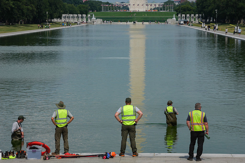
From 2010 to 2012, NPS contractors rebuilt the aging Lincoln Memorial Reflecting Pool, which had first been constructed in the early 1920s and whose water had come from the pipes that supply Washington, D.C., with its drinking water. As a result of the project, the pool now receives filtered water from the Tidal Basin through a high-density polyethylene (HDPE) pipeline.
The NPS then began a four-year restoration of the portion of the central axis of the Mall that lies between 3rd Street and 14th Street. By 2016, the restoration project had completely replaced the deteriorated and weedy turf that had previously covered much of that part of the Mall with a new cover containing soil, fescue (Festuca) and Kentucky bluegrass (Poa pratensis).
Transportation
Public transportation
The National Mall is accessible via the Washington Metro, with the Smithsonian station located on the south side of the Mall, near the Smithsonian Institution Building between the Washington Monument and the United States Capitol. The Federal Triangle, Archives, Judiciary Square and Union Station Metro stations are also located near the Mall, to the north. The L'Enfant Plaza, Federal Center Southwest and Capitol South Metro stations are located several blocks south of the Mall. Metrobus and the DC Circulator make scheduled stops near the Mall.
Bicycles
The NPS provides parking facilities for bicycles near each of the major memorials as well as along the National Mall. From March to October, an NPS concessionaire rents out bicycles at the Thompson Boat Center, located near the intersection of Virginia Avenue NW and Rock Creek and Potomac Parkway, 1 mile (1.6 km) north of the Lincoln Memorial along the Potomac River-Rock Creek Trail. The first two of five approved Capital Bikeshare stations opened on the National Mall on March 16, 2012, shortly before the start of the 2012 National Cherry Blossom Festival.
The National Mall is the official midpoint of the East Coast Greenway, a 2,900 mile–long system of shared-use bicycle trails linking Calais, Maine, with Key West, Florida.
Electric scooters and Segways
The use of an electric scooter or a Segway falls under the NPS definition of recreational use of a self-propelled vehicle. People without identified disabilities can only use such vehicles on park roadways. NPS rules, therefore, prohibit people without disabilities from using electric scooters and Segways on sidewalks and paths within the National Mall and its memorials.
Several companies rent out electric scooters within the District of Columbia. The National Mall is outside of those companies' service areas. Some such companies, therefore, charge fines for people who end their rides on the Mall. Others do not allow people to end their trips until they have left the area.
Pedicabs
The NPS licenses pedicab drivers to provide transportation and tours of the National Mall through its Commercial Use Authorization program.
Motor vehicle parking
General visitor parking is available along Ohio Drive SW, between the Lincoln and Thomas Jefferson Memorials. Bus parking is available primarily along Ohio Drive, SW, near the Lincoln and Thomas Jefferson Memorials, and along Ohio Drive SW, in East Potomac Park. There is limited handicapped parking at the Franklin Delano Roosevelt and World War II Memorials and near the Washington Monument and the Thomas Jefferson, Lincoln, Korean War Veterans, and Vietnam Veterans Memorials; otherwise, parking is extremely scarce in and near the Mall.
In April 2017, the NPS awarded a contract for the installation of parking meters on streets and in parking areas on the Mall. On June 12, 2017, the NPS and the District of Columbia Department of Public Works began to enforce metered parking on approximately 1,100 parking spaces in which motorists could previously park without charge.
Weather and climate
On July 16, 2016, speakers and musicians participated in a gathering of thousands of evangelicals during a Together 2016 rally on the Mall. Although the event was originally scheduled to conclude at 9 p.m., it ended at 4 p.m. due to excessive heat. Officers reportedly responded to 350 medical calls for heat-related injuries. The large number of people who lost consciousness because of heat syncope overwhelmed emergency medical technicians.
On July 1, 2021, an EF1 tornado formed in Arlington County, Virginia at 8:59 p.m., crossed the Potomac River near the Theodore Roosevelt Bridge, and traveled eastward along the National Mall before dissipating near 16th Street NW and Constitution Avenue south of the White House and The Ellipse, 4.4 mi (7 km) from where it had started. Its maximum winds were 90 mph (145 km/h), and it was as wide as 125 yards (114 m). The National Weather Service reported that wind damage to trees on the Mall "was prominent from 23rd St NW east for 0.75 mi (1.2 km) to near 16th Street NW south of The Ellipse". The weather service stated that the tornado lifted up and twisted temporary fencing installed on the Mall for the upcoming July 4 Independence Day celebration. The fencing landed in a "mangled and haphazard manner" before the twister dissipated at 9:05 p.m.
In popular culture
The National Mall is a common backdrop and setting for films, television shows, and other forms of media. The Mall is the setting for a famous scene in Forrest Gump, in which Forrest gives a speech during the 1967 March on the Pentagon at the Lincoln Memorial. The film National Treasure is set on and around the National Mall. The Mall is also a common setting in several superhero movies. Spider-Man: Homecoming, Captain America: The Winter Soldier, and Wonder Woman 1984 all have prominent scenes on the Mall. The comedic film Wedding Crashers is set in Washington, D.C., and has scenes on the Mall. Additionally, the mall is a common feature of the Netflix series House of Cards. The Mall is also a setting of season three, episode three of the show Family Guy, as well as season 17, episode 11 of the show, nicknamed "Trump Guy".
The National Mall appears as a battleground in 2008's Fallout 3. The location has trenches running throughout the area with factions fighting for control of the area.
News organisations that present live coverage or recorded programs from Washington often use the Mall as a backdrop.
Other attractions nearby
Other attractions within walking distance of the National Mall (proper) include:
East of the Capitol
Folger Shakespeare Library
Library of Congress
United States Supreme Court Building
Northeast of the National Mall (proper)
Holodomor Genocide Memorial
Japanese American Memorial to Patriotism During World War II
National Postal Museum
Robert A. Taft Memorial
Washington Union Station
North of the National Mall (proper)
Ford's Theatre
George Gordon Meade Memorial
Inlay of L'Enfant's plan for the federal capital city in Freedom Plaza
National Archives
National Building Museum
National Law Enforcement Museum
National Law Enforcement Officers Memorial
National Museum of Women in the Arts
National Portrait Gallery
National Theatre
Old Post Office Building and Clock Tower
Pershing Park and National World War I Memorial
Smithsonian American Art Museum
United States Navy Memorial
Northwest of the National Mall (proper)
Albert Einstein Memorial
Boy Scout Memorial
Butt–Millet Memorial Fountain
Enid Haupt Fountains
First Division Monument
German-American Friendship Garden
Interior Museum
John F. Kennedy Center for the Performing Arts
National Christmas Tree
Second Division Memorial
Settlers of the District of Columbia Memorial
Statues of the Liberators
The Ellipse
Theodore Roosevelt Island
U.S. Capitol Gatehouses and Gateposts
White House (on a line directly north of the Washington Monument)
Zero Milestone
West of the National Mall (proper)
Arlington Memorial Bridge
The Arts of War and The Arts of Peace statues at the eastern approach to the Arlington Memorial Bridge
Marine Corps War Memorial
Netherlands Carillon
Southwest of the National Mall (proper)
Arlington House, The Robert E. Lee Memorial
Arlington National Cemetery
Bureau of Engraving and Printing
Franklin Delano Roosevelt Memorial
George Mason Memorial
Jefferson Memorial
Lady Bird Johnson Park
Lyndon Baines Johnson Memorial Grove on the Potomac
Martin Luther King, Jr. Memorial
Tidal Basin
United States Forest Service Museum
United States Holocaust Memorial Museum
Women in Military Service for America Memorial
South of the National Mall (proper)
American Veterans Disabled for Life Memorial
Dwight D. Eisenhower Memorial
International Spy Museum
L'Enfant Promenade and Plaza
Museum of the Bible
Overlook in Benjamin Banneker Park