



Hurricane Erin Explodes in Strength, Becomes First Atlantic Hurricane of 2025 Season
The Atlantic’s first hurricane of 2025 just made its grand entrance — and it’s not pulling any punches. Erin officially strengthened into a hurricane Friday as it pushed toward the northeast Caribbean, triggering urgent…
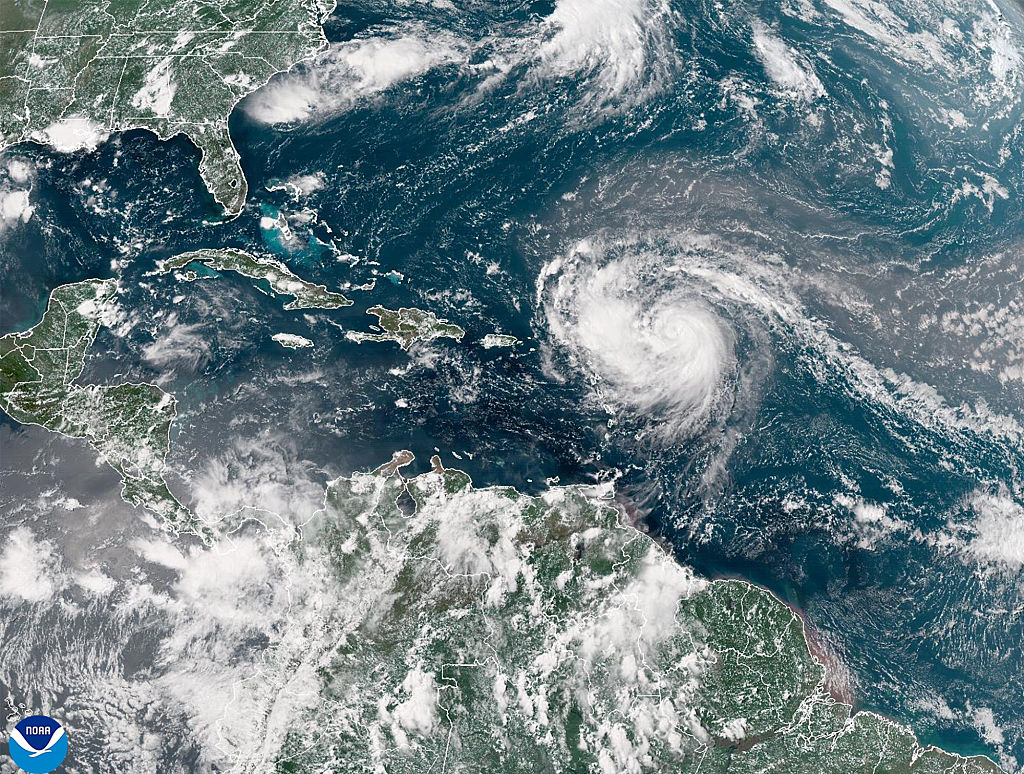
The Atlantic’s first hurricane of 2025 just made its grand entrance — and it’s not pulling any punches.
Erin officially strengthened into a hurricane Friday as it pushed toward the northeast Caribbean, triggering urgent warnings of flooding and landslides, according to the Associated Press.
While the storm is forecast to stay offshore for now, it’s already setting off alarms across the region. Tropical storm watches have been issued for several islands, including Anguilla, Barbuda, St. Martin, St. Barts, Saba, St. Eustatius, and St. Maarten.
Heavy rain is expected to slam Antigua and Barbuda, the U.S. and British Virgin Islands, and southern and eastern Puerto Rico. Forecasters warn of “up to 4 inches (10 centimeters)” of rainfall, with “isolated totals of up to 6 inches (15 centimeters),” according to the National Hurricane Center in Miami. On top of that, dangerous swells could add to the already volatile conditions.
As of Friday, the storm’s center was located about 415 miles (665 kilometers) east of the Northern Leeward Islands, packing maximum sustained winds of 75 mph (120 kph), while moving west-northwest at 17 mph (28 kph). Erin may be far from U.S. shores, but it’s drawing eyes — and concern — from meteorologists nationwide.
Hurricane specialist and storm surge expert Michael Lowry offered a glimmer of relief — for now: “The forecasts for next week still keep the future hurricane safely east of the mainland U.S.” But the path could shift.