

Roman Roads Map Shows Network Was Neither Straight Nor Rome-Centered
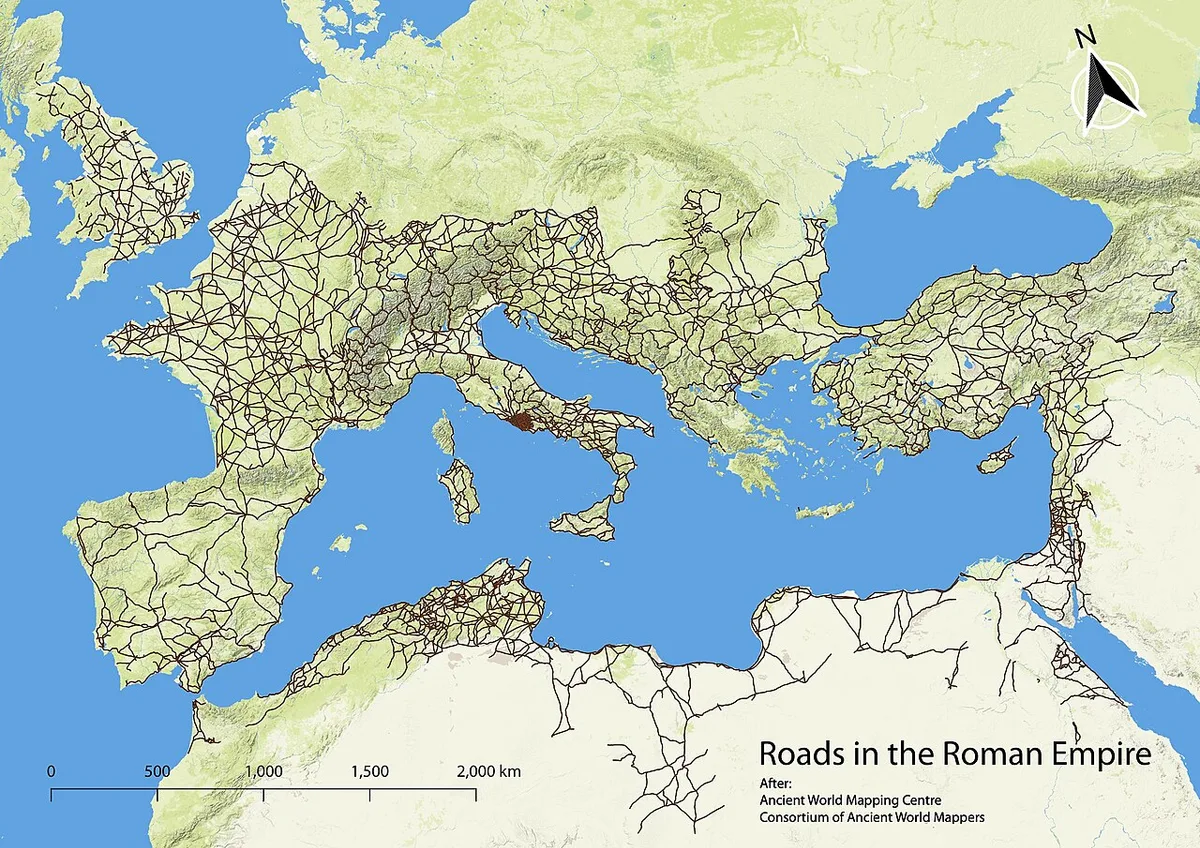
THE LEAD FACT: On September 15, 2026, researchers published in Nature Communications a detailed structural analysis of roughly 300,000 kilometers of Roman roads spanning Europe, the Middle East, North Africa and parts of western Asia. Classical archaeologist Tom Brughmans of Aarhus University and postdoctoral fellow Adam Pazout of the Autonomous University of Barcelona helped lead the work, building on the itiner-e map released the year before. Augustus had set the Milliarium Aureum in the Roman Forum in 20 BC as a symbolic starting point, but the new network measures challenge that Rome-centered picture. Brughmans said Rome was central for Mediterranean shipping and on the Tyrrhenian coast of Italy, yet not particularly central in the road system; when all movement on the Italian peninsula is considered, the most central road follows the Adriatic coast and bypasses Rome. Provincial capitals such as Ankara, London and Corinth sat exceptionally well on provincial roads for administration and tax collection. Constantinople, made imperial capital in the early fourth century AD, was exceptionally central for empire-wide overland travel—more so than Rome—with ancient Bosporus ferries linking European and Asian traffic. Roads ran straight mainly where topography allowed, as in flat parts of Belgium, northern France or the Po Valley; engineers did not move mountains. Brughmans said the infrastructure tightly integrated a vast region for people, animals, pathogens, goods and ideas, while most use was local farm-to-field and market travel. Pazout said persistence shows from Britain to the Near East, with many routes main communications through medieval times until railroads and highways. The team also noted correlation with modern highways in many regions. WHAT IS CONTESTED: No disagreement among named researchers is in the record. Outlets differ only on mile conversions of the shared ~300,000 km figure (Reuters about 190,000 miles; Gizmodo).